-
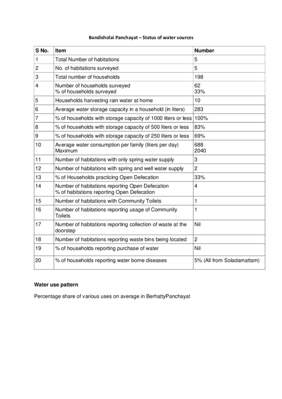
 Rain Water Harvesting
 Rainwater harvesting is a method of collecting and utilizing rainfall where it falls to minimize waste. It serves multiple purposes, including providing drinking water, irrigation, enhancing groundwater recharge, and reducing urban flooding. Key techniques include capturing rooftop runoff and seasonal floodwaters, using systems like storage tanks and recharge wells. Effective rainwater management depends on understanding local rainfall patterns and implementing structures to filter and store water. While costs can be substantial, especially for groundwater recharge systems, the benefits of sustainable water supply and reduced environmental impact make it a valuable practice in water-scarce areas.
-
 Quality of Ground Water
 Access to safe drinking water is a fundamental human right, yet in India, groundwater, which supplies 90% of rural and over 45% of urban water, often suffers from quality issues due to overexploitation and industrial contamination. Many districts report high levels of harmful substances like fluoride and arsenic, affecting millions with water-borne diseases and health risks. Groundwater quality varies based on geological factors and human activities, necessitating regular sampling and analysis to monitor safety. Improved community awareness, traditional purification methods, and sustainable management practices are essential for enhancing water quality and ensuring public health.
-
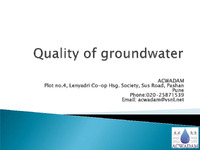
 The concept of para-hydrogeologists
 The concept of para-hydrogeologists, as proposed by ACWADAM, emphasizes the involvement of local experts in groundwater management to enhance water sustainability. These para-workers, including traditional doctors and hydrologists, aim to revive indigenous knowledge and build community capacity through training and skill development. They facilitate the connection between science and society by using local terminology and fostering participatory research methodologies. The initiative seeks to address the lack of grassroots expertise and promote eco-friendly practices while ensuring financial sustainability and ethical support. Ultimately, this approach aims to empower communities to manage their water resources effectively.
-
 The monitoring network for water resources
 The monitoring network for water resources is crucial for understanding water availability, movement, and hydro-chemical characteristics, as well as assessing the impacts of climate and estimating water budgets. It involves selecting diverse monitoring sites, including agricultural and community wells, and ensuring effective rapport with local stakeholders. Data collection includes well inventories, measurements of static and reduced water levels, and rainfall assessments, which are essential for hydrological studies. Monitoring should ideally occur monthly or at least seasonally, focusing on water quality and environmental indicators to detect contamination and track changes in water resources.
-
 Types of aquifer
 An aquifer is a rock formation that stores water and can release it for use, functioning as an underground reservoir. There are two main types: unconfined aquifers, which are directly connected to the atmosphere and fluctuate in water levels due to recharge and discharge, and confined aquifers, which are surrounded by impermeable layers and maintain water under pressure. Water can flow from unconfined aquifers to the surface, creating springs, while base flow from these aquifers contributes to stream flow, especially during dry seasons. Perched aquifers are small, limited extensions of unconfined aquifers, retaining groundwater above an impermeable layer.
-
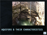 Aquifers and their characteristics
 Aquifers are underground layers of rock that store and transmit groundwater, characterized by their porosity and hydraulic conductivity. They can be classified as unconfined or confined, affecting their water storage and flow capabilities. Key factors include storativity, which indicates how much water an aquifer can yield over time, and transmissivity, which measures how easily water flows through the aquifer. High transmissivity allows wells to draw water rapidly, while storativity impacts the duration water is available. Understanding these properties is essential for managing groundwater resources effectively and ensuring sustainable water supply through wells and springs.
-
 Accumulation and Movement of groundwater
 The Advanced Center for Water Resources Development and Management (ACWADAM) focuses on understanding aquifers, which are crucial for groundwater recharge and discharge. Aquifer catchments are areas that recharge groundwater, while commands are discharge areas. Groundwater movement is influenced by water table elevation and pressure, requiring measurement of water levels. Recharge areas show diverging flow lines and fluctuating water levels, while discharge areas exhibit converging flow lines and stable water levels. Additionally, the relationship between watersheds and aquifers is complex, as one aquifer can span multiple watersheds, and vice versa, influencing both influent and effluent streams.
-
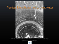 Vertical Distribution of Groundwater
 Groundwater is distributed in subsurface zones with varying characteristics. The zone of rock fracture contains openings that can hold water, while below it, the dense rock zone has limited water capacity. The zone of aeration is partially filled with air and water, supporting vegetation, while the zone of saturation is fully water-saturated, with the water table marking its upper boundary. This saturated zone can be accessed through wells, which reveal groundwater levels. Vadose hydrology, occurring above the water table, plays a crucial role in managing water transfer between surface and groundwater, influencing factors like precipitation and moisture management.
-
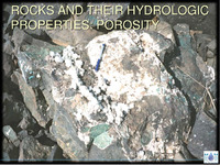 ROCKS AND THEIR HYDROLOGIC PROPERTIES_ POROSITY
 Porosity is the measure of voids in rocks, indicating their ability to hold water. It can occur in various forms, such as intergranular spaces between grains or fractures in hard rocks. Porosity is expressed as a percentage, calculated by the volume of openings divided by the total rock volume. There are two types: primary porosity, formed during rock creation, and secondary porosity, developed through weathering or fracturing. Specific yield refers to the water released by saturated rock due to gravity, while specific retention is the water retained after drainage. Understanding porosity is vital for assessing groundwater storage and movement in geological formations.
-
 Permeability
 Thermal, electrical, and hydraulic conductivity describe a material's ability to conduct heat, electricity, and groundwater, respectively. Hydraulic conductivity determines how easily water flows through rocks, with steep slopes facilitating quicker flow compared to gentle slopes. Henry Darcy's experiments in 1856 established that the flow rate of water through porous materials is proportional to the hydraulic head difference and inversely proportional to the distance between measurement points. Darcy's law quantifies groundwater flow, emphasizing the importance of hydraulic conductivity, which varies with sediment size. Ultimately, a rock's porosity and hydraulic conductivity dictate its effectiveness as an aquifer.
-
 Introduction to Soils
 Soil serves multiple essential functions, including supporting plant growth, providing habitat for organisms, recycling nutrients, and managing water supply and purification. It is composed mainly of mineral matter, water, air, and organic matter, with formation influenced by factors like parent material, climate, topography, organisms, and time. Soil is structured in layers, from the organic-rich O horizon to the unaltered R horizon. Key soil properties—such as texture, porosity, and permeability—affect water movement and retention, which vary across different soil types like alluvial, black, and lateritic soils. Understanding these characteristics is vital for effective land management.
-
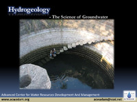 Hydrogeology - The Science of Groundwater
 Hydrogeology is the scientific study of groundwater, focusing on how water moves through geological formations, primarily rocks. Groundwater is a crucial resource, being the largest source of fresh water globally, supplying 85% of rural and 50% of urban water needs. It often exists beneath the surface and can be accessed easily, even in residential areas. This resource acts as a natural filtration system, typically maintaining good quality and stable temperatures. However, groundwater is fragile and sensitive to overuse and contamination, making it essential to understand its properties and distribution through scientific study.
-
 Drainage analysis in watershed development –A practical planning tool
 Drainage analysis involves understanding how water flows through landscapes, identifying streams and rivers within a watershed. Different drainage patterns include dendritic, trellis, rectangular, and parallel formations. Key analysis parameters include watershed area, stream orders, the number and length of streams. Important calculations are the bifurcation ratio (comparing stream orders), drainage density (total stream length per watershed area), and stream frequency (number of streams per area). This data helps in understanding watershed characteristics and hydrological behavior for effective water resource management.
-
 Weather
 The study of weather and climate is increasingly important due to climate change's impact on human life and agriculture, especially in India, where over 70% of the population relies on rain for farming. Understanding weather patterns is critical for effective watershed management and sustainable development, yet access to reliable weather data remains limited. The variability of rainfall across regions affects water resource planning, with significant changes in rainfall intensity observed in recent decades. Effective water management strategies, tailored to specific regional conditions, are essential to address issues such as water scarcity, erosion, and changing agricultural patterns.
-
 Remote Sensing in Hydrogeology
 The Advanced Center for Water Resources Development and Management focuses on understanding water sources such as rain, snow, and glaciers, which melt to form streams. Historically, aerial photography tracked glacier movement, but now satellite imagery is utilized for monitoring. Techniques for measuring snow thickness have evolved from field methods to GPS technology. The interaction of rainwater and meltwater with the ground leads to surface runoff and groundwater recharge, influenced by soil permeability. Additionally, remote sensing helps identify springs, fracture zones, and groundwater features, while thermal and microwave imagery reveal temperature variations and buried structures.
-
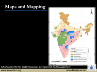 Maps and Mapping
 The Advanced Center for Water Resources Development and Management focuses on the fundamentals of map-making and geological mapping. Maps are two-dimensional representations of the Earth's surface, requiring scale, reference, and legend for accuracy. Different types of scales include verbal, graphic, and fractional. Latitude and longitude serve as a grid system for precise location identification. Maps can be classified by scale (e.g., cadastral, topographical) or content (e.g., agricultural, climatic). Geological mapping involves understanding various rock types—sedimentary, metamorphic, and igneous—along with techniques like strike and dip for visualizing rock formations. The Global Positioning System (GPS) aids in navigation and location services.
-
 Introduction to remote sensing
 Remote sensing is a technique that gathers information about objects or areas from a distance using sensors on platforms like satellites, airplanes, or balloons, without direct contact. It aids in monitoring various elements such as forests, water resources, agriculture, and urban areas, as well as dynamic phenomena like natural disasters and weather patterns. Different sensors, including cameras and thermal scanners, operate at varying distances and resolutions. Remote sensing utilizes electromagnetic energy, which can be natural or artificial, and works through atmospheric windows that allow specific wavelengths to penetrate the atmosphere. Its applications span multiple fields including geology, urban planning, agriculture, and disaster management.
-
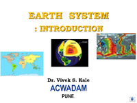 Earth System_VSK
 Dr. Vivek S. Kale's introduction to the Earth System emphasizes its dynamic nature, consisting of four key elements: lithosphere (land), hydrosphere (water), atmosphere (air), and biosphere (life). These elements interact continuously, shaping the Earth's landscape over millions of years and creating resources that we exploit for survival. Understanding geological processes, such as erosion and tectonics, is crucial for effective resource management. A holistic appreciation of these elements and processes is essential to sustainably manage and utilize Earth's resources, highlighting the need for comprehensive studies that integrate satellite data, fieldwork, and laboratory analysis.
-
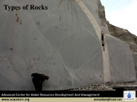 The Types of Rocks
 The document discusses the classification and characteristics of rocks and minerals. It identifies three main types of rocks: igneous, formed from cooled magma or lava; sedimentary, created from the accumulation and compaction of materials; and metamorphic, which arise from changes in existing rocks due to heat, pressure, or chemical processes. Key properties such as color, texture, and mineral composition are vital for rock identification. Additionally, it highlights that over 95% of Earth's crust is made up of silicate minerals, emphasizing the significance of these minerals in geological studies.
-
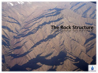 The Rock Structure
 The study of rock structure encompasses the texture, which describes the size, shape, and arrangement of grains in rocks, particularly sedimentary types that exhibit clastic texture. Structural geology focuses on the three-dimensional arrangement of rock units and their deformation history, revealing how rocks respond to various stress types like tension, compression, and shear. Key features include folds, faults, and joints, with folds representing bends from plastic deformation, while faults are fractures where rock movement occurs. Additionally, joints are weaknesses in rocks that can influence fluid movement and mineral formation. Unconformities signify gaps in geological records, indicating non-continuous sediment deposition. Overall, the characteristics of rocks affect groundwater movement and storage.
-
 Processes that shape the earth
 Groundwater movement is influenced by Earth's surface irregularities, such as hills and valleys, formed through tectonic activity and diastrophism. The lithosphere is divided into tectonic plates that move independently, causing erosion and weathering to shape landforms. Higher elevations experience greater erosion and lower weathering, while lower areas see the opposite. Weathering breaks down rocks mechanically or chemically, while erosion transports materials via agents like water, air, and ice. These processes work together to sculpt the landscape, leading to sediment deposition and eventual rock formation through compaction and diagenesis, ultimately contributing to the rock cycle.
-
 Introduction - Importance of Groundwater
 Groundwater is a crucial resource, providing 90% of rural water supply and supporting 61% of irrigation in India, highlighting its importance in agriculture and domestic use. With over 30 million irrigation wells, India is the largest global user of groundwater for farming. However, nearly 60% of districts face groundwater vulnerability due to over-extraction and quality issues. ACWADAM aims to promote sustainable groundwater management through research, training, and collaboration, addressing challenges in both rural and urban settings. Their efforts focus on developing effective management models and educating diverse audiences on groundwater issues.
-
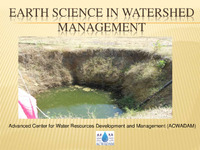 EARTH SCIENCE IN WATERSHED MANAGEMENT
 Watershed management is crucial for effective natural resource management, focusing on soil, water, and vegetation within a defined area that drains to a common outlet. It emphasizes the hydrological cycle's role and geographic diversity in managing water resources across various scales, from large regions to micro watersheds. Effective management strategies can enhance water conservation, ensure agricultural productivity, control erosion and sedimentation, and mitigate drought impacts, ultimately supporting water security and food security. Understanding the topography and hydrology of watersheds is essential for optimizing these management practices.
-
 TRAINING MATERIAL FOR PRACTICAL SESSIONS Advanced Center for Water Resources Development and Management
 The training material for practical sessions at the Advanced Center for Water Resources Development and Management covers essential topics in hydrogeology and watershed management. Key subjects include measurement units, toposheet reading, drainage analysis, and the integration of weather data for groundwater studies. Participants will learn about groundwater contour mapping, the use of Piper diagrams for water quality analysis, and methods for measuring spring discharge and water quality. The curriculum also emphasizes practical fieldwork and data collection, culminating in a socio-hydrological survey aimed at developing effective water management plans for local communities.
-
 MANAGING THE UMBARI SPRINGS:A Hydrogeological approach
 The management of the Umbari springs, crucial freshwater sources for Chorage and Jadhav Umbari villages, is increasingly challenged by changing rainfall patterns and population growth. The springs are fed by shallow aquifers in a region characterized by Deccan basalts and laterite, and their discharge is affected by the geology and seasonal precipitation. A hydrogeological study highlighted the need for a community-based approach to sustainably manage these springs, including soil conservation, repairing distribution systems, and monitoring water quality. Recommendations also suggest regulating groundwater extraction and protecting recharge areas to ensure equitable access and long-term viability of water resources.