-
 Village map of Thaala mukkai
 In this PRA map which gives you the details of the individual property details of the people in this village, they ways inside the village. Forest areas in the boundaries of this village.
-
Village map of Paikkal
The details such as variety of cultivation, water source for the people, and the boundaries of the individual farmers land.
-
Village map of Parpanai, kotagiri
This is a PRA map which shows details such as tanks, boundaries, houses, land partitions of the individuals and common ares.
-
Village map of Nadur, kotagiri
This is a PRA map which shows details such as variety of trees, water reservoir, lands of individuals and common areas
-
Village map of vekkipadigai, kotagiri
This is a PRA map which shows details such as tanks, boundaries, houses, land partitions of the individuals and common ares.
-
Village map of mallikorai, coonoor
This map showes the details of fountains, water sources, variety of trees, land sliding areas and individual argicultural land,
-
Village map of Veeracombai, coonoor
This is a PRA map which shows details such as fountains, wells, temples, land partitions of the individuals and common ares.
-
Village map of Bangala padigai, kotagiri
-
Village Map of Nedugalcombei, Coonoor
This is a PRA map which shows details such as spring well, tank, temple, agricultural lands. It details land parcels belonging to individuals and common lands.
-
Garikyur, Aracode region
PRA Map
-
Boothanatham, Sigur region
PRA Map
Participatory Resource Mapping
-
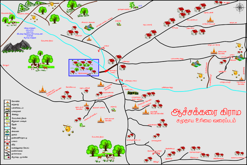
Achakkarai, Sigur region
Participatory Resource Appraisal - FRA Maps