
Items
Tag
GPS
-
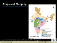 Maps and Mapping The Advanced Center for Water Resources Development and Management focuses on the fundamentals of map-making and geological mapping. Maps are two-dimensional representations of the Earth's surface, requiring scale, reference, and legend for accuracy. Different types of scales include verbal, graphic, and fractional. Latitude and longitude serve as a grid system for precise location identification. Maps can be classified by scale (e.g., cadastral, topographical) or content (e.g., agricultural, climatic). Geological mapping involves understanding various rock types—sedimentary, metamorphic, and igneous—along with techniques like strike and dip for visualizing rock formations. The Global Positioning System (GPS) aids in navigation and location services.