Items
Tag
Hydrogeological assessment
-
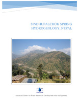
 Sindhupalchok Spring hydrogeology, Nepal The technical report on Sindhupalchok's hydrogeology highlights the region's complex geology, featuring schists and gneisses, and the impact of recent earthquakes on spring behavior. The study identified six springs and assessed their recharge areas, noting that many springs have dried up or changed due to geological disturbances. Recommendations include implementing staggered contour trenching and vegetation planting to enhance groundwater recharge, particularly in areas used for agriculture. Overall, Sindhupalchok has significant groundwater resources, necessitating effective management and awareness to maintain sustainability amid environmental changes.
 -
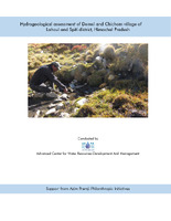
 Hydrogeological assessment of Demul and Chicham, Spiti The hydrogeological assessment of Demul and Chicham villages in the Spiti Valley, Himachal Pradesh, highlights significant challenges related to water sources amidst climate change impacts. Springs serve as the primary water supply for local communities, providing essential drinking and irrigation water. However, the region has seen a decline in spring discharge due to changes in precipitation patterns, particularly reduced snowfall. This situation has raised concerns about sustainable livelihoods in these villages, prompting an initiative by Ecosphere and ACWADAM to identify potential recharge areas for aquifers that feed these vital springs. The study documented over ten springs in both villages, with water quality testing indicating varying levels of Total Dissolved Solids (TDS) and salinity. While some springs met drinking water standards, others showed elevated pH levels, necessitating further investigation into potential contamination sources. The report suggests implementing recharge structures, such as trenches and percolation pits, in identified recharge zones to enhance groundwater levels. These efforts aim to mitigate the adverse effects of climate change on water availability, ensuring that local communities can maintain their livelihoods in an increasingly unpredictable environment. In conclusion, the delicate ecosystems in the Spiti Valley are facing mounting pressure from climate change, leading to a water crisis that threatens the sustainability of Demul and Chicham villages. With changing snowfall patterns and rising temperatures, proactive measures are essential to secure water supplies through innovative interventions. The collaboration between local communities and organizations like Ecosphere illustrates a commitment to balancing conservation and development, ultimately fostering resilience against ongoing climate challenges while supporting sustainable livelihoods in the region.
 -
 Hydrogeological assessment for planning springshed management in Bans-Pabhe The hydrogeological assessment of the Bans-Pabhe springshed in Pithoragarh, Uttarakhand, conducted by the Advanced Center for Water Resources Development and Management, focuses on managing local water resources effectively. The study area, positioned within the Chandaak-Aulaghat watershed, includes significant springs such as Digtoli-Seem, Bans-Pabhe, and Jajrauli-Baksil. A detailed inventory identified 131 springs, with 52 situated in the targeted springsheds. The geological framework comprises Proterozoic rock formations characterized by limestone, dolomite, and phyllite, which influence water flow and spring characteristics in the region. Key findings reveal that the springs in the Bans-Pabhe area are primarily influenced by secondary porosity and permeability due to the presence of fractures in the rock formations. The Kafaldhungri Dhara and Kutuadhara springs are perennial, while Kasni Dhara and Pabhe Naula are seasonal. Discharge rates fluctuate significantly, particularly during lean periods, indicating a pressing need for effective recharge measures. Strategies include contour trenching and afforestation to enhance aquifer recharge, especially as agricultural practices threaten the natural water supply. In conclusion, the assessment underscores the importance of continuous monitoring and sustainable management of groundwater resources in the Bans-Pabhe springshed. Implementing recharge techniques and protecting the existing vegetation are vital to mitigate the declining discharge rates and ensure a stable water supply for local communities dependent on these springs. Ongoing research and collaboration among stakeholders are essential for addressing water scarcity challenges in the region.
