-
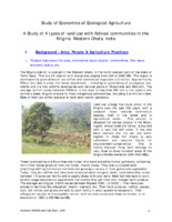 SANFEC-Keystone Report
 This document examines agricultural practices and land use among indigenous communities in the Nilgiris region of India, focusing on the impacts of monoculture, particularly tea and coffee plantations, on biodiversity, soil health, and local economies. The study highlights the shift from traditional mixed agriculture to cash crops, which has led to increased reliance on chemical fertilizers and pesticides, negatively affecting soil quality and food security. It emphasizes the importance of promoting sustainable farming practices, such as intercropping and organic methods, to enhance food diversity and economic viability for local farmers. Additionally, the research includes detailed assessments of crop production, water sources, and social aspects of farming, aiming to document and compare the benefits of diverse agricultural systems against conventional practices.
-
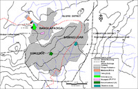 Sanfec Farmers Map
-
 PME Keystone Foundation_Complete
-
 PME Field Experience_Sneh_Book
 This document, titled "Participatory Monitoring and Evaluation: Field Experiences," was requested by twelve partners of the SDC/IC NGO Programme Karnataka-Tamil Nadu. The partners adopt a participatory approach to development, based on a well-established rapport with the village communities. All activities are planned and reviewed through group discussions, often using participatory tools. However, there has been little systematic community-based monitoring and evaluation. The document aims to provide development field workers with specific examples of participatory monitoring and evaluation using various tools, with a focus on the latter, given the programme cycle. The document is being produced in English, Kannada, and Tamil, and will also be published in Kannada and Tamil. Participatory monitoring evaluation (PME) is an integrated part of planning and implementing project activities, and should be discussed, identified, and agreed with community stakeholders at the beginning. In cases where a rigorous PME process is not put in place, participatory methods can still capture community perceptions of change and build on informal systems of monitoring through observations and community discussions.
-
 Kitchen Garden_ Nilambur
-
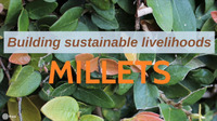 Millets
-
 Millets in the Nilgiris - DDS, Hyderabad - June 2008
-
 Millet initiatives - Traditional Millet Farming in Nilgiri Biosphere Reserve
-
 Land Development Initiative - SDC ICl
-
 Land Chapter_ Land Development and Traditional Agriculture Revival
-
 Kitchen Garden Report
-
 Dehusker
-
 Coffee Story
-
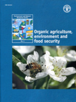 Land development and revival of traditional agriculture with tribal communities in the Nilgiris_170_Case_study_3
-
 Aragani
-
 Agriculture_For_Punjanur area
-
 Ann's Report _ Food Security amongst Tribal Communities in the Nilgiri's.
-
 Case studies in 2009
-
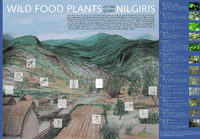 Wild food plants of the lower Nilgiri
-
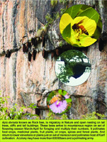 Pollinator Book
 The document discusses various species of pollinators, including bees, wasps, and beetles, highlighting their roles in pollinating a wide range of plants, including crops and wild flora. It emphasizes the importance of these pollinators, such as the Indian hive bee and the migratory rock bee, in enhancing agricultural yields and maintaining biodiversity. The text also addresses the ecological challenges faced by these species, such as habitat loss and the need for conservation efforts, while outlining the benefits of pollination for food production and ecosystem health. Additionally, it notes the significance of both self and cross-pollination processes facilitated by these insects, which are crucial for seed development in plants.
-
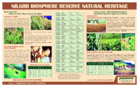 Poster on Millet's
 The document, seemingly part of a series titled "Indigenous People & Livelihoods," lists various crops and produce with names in a local language, The document is from A GROUP FOR ECO-DEVELOPMENT INITIATIVES, Keystone Centre, Kotagiri, Nilgiris, India.
-
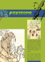 Poster on Keystone's Program
-
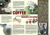 Poster on Coffee
-
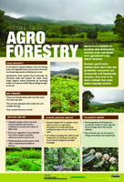 Poster on benefits of Agroforestry
-
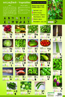 Poster on Vegetables
 SANFEC-Keystone Report This document examines agricultural practices and land use among indigenous communities in the Nilgiris region of India, focusing on the impacts of monoculture, particularly tea and coffee plantations, on biodiversity, soil health, and local economies. The study highlights the shift from traditional mixed agriculture to cash crops, which has led to increased reliance on chemical fertilizers and pesticides, negatively affecting soil quality and food security. It emphasizes the importance of promoting sustainable farming practices, such as intercropping and organic methods, to enhance food diversity and economic viability for local farmers. Additionally, the research includes detailed assessments of crop production, water sources, and social aspects of farming, aiming to document and compare the benefits of diverse agricultural systems against conventional practices.
 Sanfec Farmers Map
 PME Keystone Foundation_Complete
 PME Field Experience_Sneh_Book This document, titled "Participatory Monitoring and Evaluation: Field Experiences," was requested by twelve partners of the SDC/IC NGO Programme Karnataka-Tamil Nadu. The partners adopt a participatory approach to development, based on a well-established rapport with the village communities. All activities are planned and reviewed through group discussions, often using participatory tools. However, there has been little systematic community-based monitoring and evaluation. The document aims to provide development field workers with specific examples of participatory monitoring and evaluation using various tools, with a focus on the latter, given the programme cycle. The document is being produced in English, Kannada, and Tamil, and will also be published in Kannada and Tamil. Participatory monitoring evaluation (PME) is an integrated part of planning and implementing project activities, and should be discussed, identified, and agreed with community stakeholders at the beginning. In cases where a rigorous PME process is not put in place, participatory methods can still capture community perceptions of change and build on informal systems of monitoring through observations and community discussions.
 Kitchen Garden_ Nilambur
 Millets
 Millets in the Nilgiris - DDS, Hyderabad - June 2008
 Millet initiatives - Traditional Millet Farming in Nilgiri Biosphere Reserve
 Land Development Initiative - SDC ICl
 Land Chapter_ Land Development and Traditional Agriculture Revival
 Kitchen Garden Report
 Dehusker
 Coffee Story
 Land development and revival of traditional agriculture with tribal communities in the Nilgiris_170_Case_study_3
 Aragani
 Agriculture_For_Punjanur area
 Ann's Report _ Food Security amongst Tribal Communities in the Nilgiri's.
 Case studies in 2009
 Wild food plants of the lower Nilgiri
 Pollinator Book The document discusses various species of pollinators, including bees, wasps, and beetles, highlighting their roles in pollinating a wide range of plants, including crops and wild flora. It emphasizes the importance of these pollinators, such as the Indian hive bee and the migratory rock bee, in enhancing agricultural yields and maintaining biodiversity. The text also addresses the ecological challenges faced by these species, such as habitat loss and the need for conservation efforts, while outlining the benefits of pollination for food production and ecosystem health. Additionally, it notes the significance of both self and cross-pollination processes facilitated by these insects, which are crucial for seed development in plants.
 Poster on Millet's The document, seemingly part of a series titled "Indigenous People & Livelihoods," lists various crops and produce with names in a local language, The document is from A GROUP FOR ECO-DEVELOPMENT INITIATIVES, Keystone Centre, Kotagiri, Nilgiris, India.
 Poster on Keystone's Program
 Poster on Coffee
 Poster on benefits of Agroforestry
 Poster on Vegetables
