-
 The Tamil Nadu (Additional Assessment and Additional Water-Cess) Act,
1963
The Tamil Nadu (Additional Assessment and Additional Water-Cess) Act,
1963 The Tamil Nadu Additional Assessment and Additional Water-Cess Act of 1963 establishes a framework for levying additional assessments and water-cess on specific lands in Tamil Nadu. It aims to regulate land revenue for irrigation purposes, defining terms related to irrigation sources and land types. Amendments have been made over the years to clarify definitions and adjust rates for different crop types. The document includes disclaimers about the reliability of the information provided, stating that it should not be solely relied upon for legal or professional decisions, and emphasizes that authoritative texts should be consulted for accuracy.
-
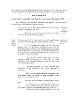 The Tamil Nadu Town and Country Planning (Amendment) Act
 The Tamil Nadu Town and Country Planning (Amendment) Act, 2010, received the Governor's assent on November 29, 2008, and is set to take effect from January 1, 2011. This Act amends the original Town and Country Planning Act of 1971 by introducing Section 47-A, which requires individuals seeking to develop land in non-planning areas to apply for permission from local authorities. Prior approval from the Director and, in cases involving wet lands, from the District Collector is also necessary. The Act outlines the consequences for unauthorized land development and specifies the definition of "wet land" as per existing legislation.
-
 Government Open Data Use License - India National Data Sharing and Accessibility Policy Government of India
 The Government of India's National Data Sharing and Accessibility Policy (NDSAP), established in 2012, emphasizes the importance of open data for governance and public use. This policy facilitates accessible, structured data under an open license, allowing users to adapt and redistribute data for both commercial and non-commercial purposes. Users must provide proper attribution and cannot misuse or misrepresent the data. Exemptions include personal information and data not authorized for sharing. The license is governed by Indian law, includes provisions for dispute resolution, and mandates that published data remain available for reference.
-
 Ooty Urbanization in Ecologically Fragile Area
 The case study on Ooty, part of the Rockefeller-IIHS initiative, examines urbanization in the ecologically sensitive Western Ghats, highlighting the challenges of balancing development and environmental conservation. With nearly 48% of the Western Ghats' population in urban areas, understanding urban impacts is crucial. Ooty's growth trajectory reflects its unique ecological context, necessitating governance frameworks that address both urban planning and environmental preservation. The study emphasizes the need for integrated strategies to mitigate environmental degradation while accommodating urban demands, particularly in tourism, which strains local resources and infrastructure. Sustainable practices are essential to preserve the region's biodiversity and cultural heritage.
-
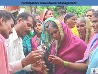 Participatory Groundwater Management
 Participatory Groundwater Management (PGWM) emphasizes community involvement in managing groundwater resources, addressing issues related to equity and sustainability. Traditional methods have often neglected community perspectives and supportive legal frameworks. Successful initiatives like Pani Panchayat in Maharashtra and APFAMGS in Andhra Pradesh showcase how local governance and participatory approaches can effectively manage groundwater. These programs involve collective decision-making, demand management, and sustainable practices, such as banning water-intensive crops. For PGWM to thrive, it requires collaboration, capacity building, and data-driven strategies, ensuring that groundwater is recognized as a common pool resource that benefits all community members.
-
 Groundwater Governance
 Groundwater governance is increasingly important as global groundwater extraction has surged, with India, the USA, and China using nearly half of it. In India, groundwater management faces challenges due to unclear legal frameworks, insufficient data, and weak institutional support. Critical areas like Kerala and Punjab are experiencing over-exploitation. Effective governance requires community participation, regulations, and awareness initiatives. Internationally, many countries have implemented groundwater legislation and agreements to manage shared resources. A proposed model bill emphasizes groundwater as a public trust, advocating for the protection and regulation of this vital resource while promoting sustainable practices.
-
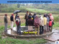 Experience in Groundwater Management Case Studies_ACWADAM
 ACWADAM's groundwater management initiatives highlight successful community-based strategies in three villages: Pondhe, Muthalane, and Randullabad. In Pondhe, a formal water user group system is established to manage irrigation solely through dug wells, with regulations to prevent overexploitation and ensure equitable water distribution. Muthalane, a tribal region, focuses on community participation and sustainable practices, with new wells and repairs planned to enhance water access. Randullabad employs effective monitoring and management of its aquifers, promoting sustainable irrigation practices. Overall, these case studies demonstrate the importance of community engagement and strategic planning in groundwater management.
-
 HYDROGEOLOGICAL MAPPING USING WELL LOGS
 Hydrogeological mapping involves collecting and representing data on groundwater through well logs. Key methods include using tools like GPS, cameras, clinometers, and field diaries for data collection, while representation is done via Excel, Google Earth, and software like Corel Draw and ArcGIS. Well inventory is critical, documenting details such as depth, casing, water levels, and quality parameters like pH and salinity. This data helps create depth profiles and geologic sections, which are visually represented on maps and graphs to analyze groundwater behavior effectively in specific areas, such as Shambhukalan village in Punjab.
-
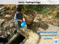 Socio - hydrogeology Linking social and hydrogeological systems
 The discussion highlights the critical link between groundwater and societal needs in India, where groundwater supplies 90% of rural drinking water and 70% of irrigation. Despite its importance, 60% of Indian districts face groundwater issues related to availability and quality. Key factors influencing groundwater development include technological advancements, land scarcity, and changing cropping patterns. Governance challenges arise from inadequate regulation and enforcement, while competition for groundwater often leads to local inequities rather than outright conflict. Effective management requires a coordinated approach that integrates social equity, economic efficiency, and sustainable practices to address groundwater as a common pool resource.
-
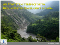 AN ECOSYSTEM PERSPECTIVE TO GROUNDWATER GOVERNANCE IN INDIA
 The governance of groundwater in India faces significant challenges due to varying aquifer types, overexploitation, and climate change impacts. With over 30 million wells, groundwater serves as a critical resource for both domestic and industrial use, despite being underutilized and poorly managed in many regions. Effective groundwater management requires a comprehensive understanding of aquifer dynamics, community participation, and regulatory frameworks that balance extraction with sustainability. Prioritizing equitable access, protecting recharge areas, and engaging users in decision-making are essential for addressing water scarcity and ensuring long-term water security across diverse ecosystems.
-
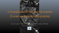 Groundwater in the alluvial systems
 Groundwater management in alluvial aquifer systems, particularly in regions like Neemrana, Rajasthan, presents challenges due to slow recharge and significant vulnerabilities. Effective water management strategies are essential, emphasizing the need for local governance to regulate groundwater use and implement best practices. In North Bihar, where 80% of water sources are groundwater-based, issues like drinking water scarcity and contamination during floods highlight the urgent need for improved sanitation and access to safe water. Reviving traditional water management systems and focusing on recharge structures near ridges can enhance groundwater sustainability in these areas.
-
 GEOHYDROLOGICAL CATCHMENT ASSESSMENT_ BHAMA -ASKHED DAM AND PART CATCHMENT AREA OF CHAS -KAMAN DAM
 The geohydrological assessment of the Bhama-Askhed Dam and Chas-Kaman Dam catchment areas in Pune, Maharashtra aims to identify vulnerable groundwater recharge zones for infrastructure projects. The study involves geological mapping, drainage analysis, and the development of conservation structure recommendations. Key findings reveal varied geomorphology, with the Bhama river as the primary drainage, and suggest significant recharge vulnerabilities due to disturbances from land-use changes, including windmill installations. The assessment highlights that certain recharge zones are critical for maintaining aquifer potential and emphasizes the need for conservation efforts in these areas to ensure groundwater sustainability.
-
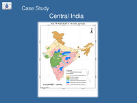 Case Study Central India
 The project in Central India, led by the Advanced Center for Water Resources Development and Management and Samaj Pragati Sahayog, focuses on sustainable groundwater management in Bagli Tehsil, where reliance on groundwater is increasing but data for effective planning is lacking. It involves gathering hydrogeological data and community participation to create a comprehensive understanding of groundwater resources. This includes monitoring water levels, quality, and recharge rates across various aquifers, developing protocols for responsible water use, and implementing measures to protect recharge areas and regulate abstraction. The goal is to ensure equitable management of groundwater resources amid rising demand.
-
 BOHAL SPRING CASE STUDY
 The Bohal Spring, situated in Bohal Village near Palampur, has experienced a decline in water discharge and quality over the past decade due to human activities. To address these issues, a study aims to create a hydrogeological map, identify recharge zones, and develop a spring management plan focused on protection and conservation. Key recommendations include community-led protection initiatives, catchment treatment measures, and monitoring of rainfall and water quality. A formal agreement between the Palampur Municipal Committee and the local Village Forest Development Society will facilitate sustainable management, including financial support and restrictions on resource use to enhance the spring's viability.
-
 GROUNDWATER BALANCE
 The groundwater balance in an aquifer involves the assessment of inputs like recharge from precipitation and outputs such as discharge from pumping and baseflow. Different watershed scenarios can affect this balance, with variations in aquifer types—deep, shallow, or a combination. Key components include groundwater pumping, which significantly impacts the natural flow and baseflow contributions to streams. The balance can be quantified by measuring discharge and calculating specific yield, which estimates storage changes. For effective management, understanding the relationship between recharge (38% of rainfall) and discharge is crucial, ensuring sustainable aquifer levels amid varying climatic conditions.
-
 Hydrogeology-Sanitation linkages
 Effective management of wastewater and solid waste is crucial for public health and environmental sustainability. This includes safe collection, treatment, and recycling of household wastewater, human excreta, and solid waste, alongside stormwater drainage and hazardous waste management. Urban areas typically rely on sewer systems for off-site sanitation, while rural areas may use septic tanks or soak pits for on-site solutions. Key factors influencing the movement of pathogens through soil include filtration and adsorption, which help reduce contaminants. Understanding these processes and implementing proper sanitation practices are essential for reducing health risks and protecting groundwater.
-
 Understanding Competition & Conflict_ GROUNDWATER
 Groundwater in North Bihar faces increasing competition as multiple users—farmers, industries, and urban areas—vie for limited resources, leading to potential conflicts. Approximately 30 million wells provide crucial water for drinking, agriculture, and industry, but the reliance on groundwater is challenged by quality issues, such as arsenic and iron contamination. The lack of understanding and data on aquifers exacerbates tensions among users, as individual land ownership complicates access. Sustainable groundwater management must focus on equitable resource use, recharge strategies, and addressing exploitation risks to ensure long-term viability for all stakeholders involved.
-
 Aquifer Mapping Process
 The aquifer mapping process involves several key steps to assess groundwater resources effectively. It begins with reconnaissance to analyze regional groundwater dependence using various data sources. Surveys follow, including geological mapping and well inventories, supported by geophysical surveys to enhance data accuracy. Groundwater levels and quality are then monitored regularly to gather seasonal insights. The process culminates in aquifer conceptualization, where data is overlaid to create a comprehensive aquifer map detailing characteristics like storage, quality, and recharge potential. Finally, ongoing monitoring and adjustments are made to manage groundwater sustainably and address any emerging issues.
-
 SPRINGS : IMPORTANT HYDROGEOLOGICAL ASPECTS
 Springs are vital hydrogeological resources shared among users, with access often through common sources. Effective management requires mapping and characterizing springs, assessing their geological features, and monitoring factors like discharge and water quality. Community involvement is crucial for data collection and decision-making in spring management. Springs vary greatly in their discharge characteristics and aquifer types, influencing their recharge dynamics and water quality. Strategies for capacity building include planning interventions for recharge and protection, ultimately aiming for sustainable use of these essential water sources.
-
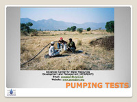 Pumping Test methodology
 Pumping tests are essential procedures used to evaluate how aquifers respond to water extraction from wells. They help well-owners determine their well's yield, the appropriate pump capacity, and aquifer characteristics like Transmissivity and Storativity. The tests involve pumping water from a well, measuring the resulting changes in water levels in both the pumping and nearby observation wells. There are two main types of tests: well tests, focusing on the well's performance, and aquifer performance tests, which assess aquifer properties. Data collected during these tests informs on drawdown, recovery rates, and the aquifer's behavior under varying pumping conditions.
-
 Pumping test analysis
 The analysis of pumping tests aims to evaluate aquifer properties, specifically Transmissivity (T) and Storativity (S), as well as well characteristics like yield. These tests involve measuring drawdown in pumping and observation wells over time and assessing recovery after pumping stops. Various methods exist for interpreting this data, with graphical techniques such as the Cooper-Jacob method being common. Specific capacity, which indicates a well's ability to yield water, is derived from pump discharge and drawdown measurements. Different approaches are used for bore and dug wells, with Slichter’s method applicable for dug wells to estimate specific capacity based on recovery data.
-
 Introduction to springs
 The document discusses the significance of springs, particularly in India, highlighting their role as natural groundwater discharge points that sustain streams and rivers. It outlines the extensive presence of springs across various regions, including the Himalayas and Western Ghats, and notes the lack of comprehensive data on groundwater resources. Springs are categorized into different types based on their formation processes, such as depression, fracture, and karst springs. The text emphasizes the need to shift focus from viewing groundwater merely as a source to understanding it as a vital resource, advocating for improved monitoring and management practices to ensure water quality and availability.
-
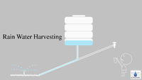 Rain Water Harvesting
 Rainwater harvesting is a method of collecting and utilizing rainfall where it falls to minimize waste. It serves multiple purposes, including providing drinking water, irrigation, enhancing groundwater recharge, and reducing urban flooding. Key techniques include capturing rooftop runoff and seasonal floodwaters, using systems like storage tanks and recharge wells. Effective rainwater management depends on understanding local rainfall patterns and implementing structures to filter and store water. While costs can be substantial, especially for groundwater recharge systems, the benefits of sustainable water supply and reduced environmental impact make it a valuable practice in water-scarce areas.
-
 Quality of Ground Water
 Access to safe drinking water is a fundamental human right, yet in India, groundwater, which supplies 90% of rural and over 45% of urban water, often suffers from quality issues due to overexploitation and industrial contamination. Many districts report high levels of harmful substances like fluoride and arsenic, affecting millions with water-borne diseases and health risks. Groundwater quality varies based on geological factors and human activities, necessitating regular sampling and analysis to monitor safety. Improved community awareness, traditional purification methods, and sustainable management practices are essential for enhancing water quality and ensuring public health.
-
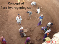 The concept of para-hydrogeologists
 The concept of para-hydrogeologists, as proposed by ACWADAM, emphasizes the involvement of local experts in groundwater management to enhance water sustainability. These para-workers, including traditional doctors and hydrologists, aim to revive indigenous knowledge and build community capacity through training and skill development. They facilitate the connection between science and society by using local terminology and fostering participatory research methodologies. The initiative seeks to address the lack of grassroots expertise and promote eco-friendly practices while ensuring financial sustainability and ethical support. Ultimately, this approach aims to empower communities to manage their water resources effectively.
