
Items
Tag
Hydrogeology
-
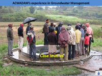 Experience in Groundwater Management Case Studies_ACWADAM ACWADAM's groundwater management initiatives highlight successful community-based strategies in three villages: Pondhe, Muthalane, and Randullabad. In Pondhe, a formal water user group system is established to manage irrigation solely through dug wells, with regulations to prevent overexploitation and ensure equitable water distribution. Muthalane, a tribal region, focuses on community participation and sustainable practices, with new wells and repairs planned to enhance water access. Randullabad employs effective monitoring and management of its aquifers, promoting sustainable irrigation practices. Overall, these case studies demonstrate the importance of community engagement and strategic planning in groundwater management.
 -
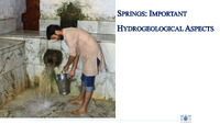 SPRINGS : IMPORTANT HYDROGEOLOGICAL ASPECTS Springs are vital hydrogeological resources shared among users, with access often through common sources. Effective management requires mapping and characterizing springs, assessing their geological features, and monitoring factors like discharge and water quality. Community involvement is crucial for data collection and decision-making in spring management. Springs vary greatly in their discharge characteristics and aquifer types, influencing their recharge dynamics and water quality. Strategies for capacity building include planning interventions for recharge and protection, ultimately aiming for sustainable use of these essential water sources.
 -
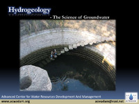 Hydrogeology - The Science of Groundwater Hydrogeology is the scientific study of groundwater, focusing on how water moves through geological formations, primarily rocks. Groundwater is a crucial resource, being the largest source of fresh water globally, supplying 85% of rural and 50% of urban water needs. It often exists beneath the surface and can be accessed easily, even in residential areas. This resource acts as a natural filtration system, typically maintaining good quality and stable temperatures. However, groundwater is fragile and sensitive to overuse and contamination, making it essential to understand its properties and distribution through scientific study.
 -
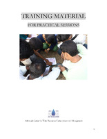 TRAINING MATERIAL FOR PRACTICAL SESSIONS Advanced Center for Water Resources Development and Management The training material for practical sessions at the Advanced Center for Water Resources Development and Management covers essential topics in hydrogeology and watershed management. Key subjects include measurement units, toposheet reading, drainage analysis, and the integration of weather data for groundwater studies. Participants will learn about groundwater contour mapping, the use of Piper diagrams for water quality analysis, and methods for measuring spring discharge and water quality. The curriculum also emphasizes practical fieldwork and data collection, culminating in a socio-hydrological survey aimed at developing effective water management plans for local communities.
 -
 Spring Hydrogeology of Diktoli-Sim ACWADAM's report on the Diktoli-Sim springshed in Uttarakhand, India, emphasizes the importance of groundwater recharge in the Chanda K-Aulaghat watershed. The report identifies Diktoli as a micro-watershed and highlights its geological features, including various rock types such as quartzite, slate, and limestone, which influence water flow. It details the spring inventory, revealing 20 springs, with three—Shivalay, Naunipani, and Dhara—selected for Sustainable Spring Management (SSM) activities. Recommendations include implementing recharge structures like staggered contour trenches and protecting forested areas to enhance water quality and availability for local communities.
 -
 Scientific and Technical inputs to spring shed management The project aims to improve spring water management in five districts of Nagaland, addressing the region's critical water scarcity issues exacerbated by climate change and land use. Collaborating with local organizations, the initiative focuses on providing secure drinking water, conducting springshed surveys, and educating communities on hydrogeology. Key objectives include identifying recharge zones, building local capacity for spring protection, and advocating for spring-specific policies. The study also highlights the need for a sustainable approach to water management, ensuring the preservation of traditional water sources while adapting to changing environmental conditions.
 -
 Regional hydrogeology of the Tendong Hills and a rapid hydrogeological assessment for Kitam The report discusses the complex hydrogeological dynamics of the Tendong Hills and Kitam area in Sikkim, highlighting the interplay of diverse rock types and structures that influence the region's aquifers and spring systems. It emphasizes the importance of incorporating geological insights into watershed and spring development programs to enhance water security, especially in light of climate change and human activities. ACWADAM is actively involved in developing hydrogeologically informed recharge strategies for springs in these areas, aiming to improve water management and community capacity building. The report also outlines specific recharge areas and spring characteristics, underscoring the need for careful monitoring and management to ensure sustainable water supply.
 -
 HYDROGEOLOGY BASED CATCHMENT AREA PLANNING FOR SPRING WATER MANAGEMENT IN TUENSANG DISTRICT , NAGALAND The ACWADAM report outlines a hydrogeological assessment aimed at managing spring water resources in Tuensang district, Nagaland. It highlights the critical state of freshwater availability due to population growth and environmental changes, emphasizing the need for effective groundwater conservation strategies. The study involves mapping spring locations, monitoring discharge, identifying recharge areas, and developing hydrogeological layouts. It suggests action-oriented measures like constructing recharge pits and trenches while promoting community involvement in groundwater management. Ultimately, the report advocates for sustainable practices to protect water resources and enhance local water supply systems.
 -
 Hydrogeology based spring shed management plan in Khar, Nepal The report presents a hydrogeology-based management plan for springs in Khar, Darchula District, Nepal, focusing on the Dallekh-Sundamunda springshed. It identifies 48 springs, emphasizing their dependence on geological features, such as slates and fractures, for groundwater movement and accumulation. To enhance water availability, the report recommends targeted recharge measures, like constructing contour trenches and check-dams, particularly in areas with dense vegetation and agricultural land. The study highlights the need for ongoing data collection, geological assessments of additional springs, and training local residents in groundwater management practices.
 -
 Hydrogeological assessment of Tendong Hills Region The report by ACWADAM outlines the hydrogeological assessment of the Tendong Hill region in South Sikkim, as part of the Village Water Security Plan (VWSP) development project in collaboration with RMDD and GIZ. It highlights the intricate relationship between the diverse rock types and structures in the Himalayas and their impact on the hydrogeological environment. The assessment reveals that the local aquifers are often discontinuous and can vary significantly in size and discharge, leading to challenges in water management for surrounding villages. Additionally, the report emphasizes that existing watershed development programs often overlook geological factors, risking project efficacy and sustainability. Key findings from the assessment indicate that springs in the Tendong Hills are primarily influenced by geological structures, including faults and fractures that dictate spring locations and discharge behaviors. The study identifies crucial recharge areas for these springs and underscores the necessity of integrating geological insights into water management strategies. ACWADAM's efforts include monitoring spring discharge and water quality, along with community capacity building for better management practices. The Dhara Vikas project, which aims to conserve springs, relies on ACWADAM's hydrogeological expertise to inform its methodologies. In conclusion, the report suggests a regional implementation plan to enhance water security in the Tendong Hill area, particularly for villages facing water scarcity. The proposed VWSP will address specific village needs while incorporating a holistic understanding of the local hydrogeological context. By engaging local communities and leveraging scientific research, the project aims to create sustainable water management practices that are resilient to both climatic and anthropogenic pressures, ultimately fostering greater water security for the region's inhabitants.
 -
 Handout Himmotthan The document discusses various rock types and their mineral compositions, focusing on their grain sizes, porosity, permeability, and impacts on water quality. It categorizes rocks into several groups, including mudstone, limestone, schist, granite, and basalt, highlighting their mineral content such as quartz, feldspar, calcite, and mica. For instance, mudstone and claystone are characterized by very fine grains and high porosity but low permeability, while limestone and dolomite contain larger grains of calcite and dolomite, often resulting in higher salinity and total dissolved solids (TDS). The text emphasizes that the presence of minerals like feldspar significantly influences water quality, particularly in terms of TDS and pH levels. Generally, rocks with higher feldspar content contribute to increased salinity and TDS, whereas those with clay and mica tend to have a minimal effect on these parameters. The summary concludes with an overview of how grain size and mineral composition affect the overall hydrological dynamics within different geological formations. Understanding these characteristics is crucial for effective water resource management in various environments.
 -
 DAILEKH SPRINGS The hydrogeological study of Dailekh Springs, conducted by ACWADAM in collaboration with ICIMOD, focused on analyzing ten springs in the region to develop conceptual models and identify groundwater recharge sites. The investigation involved detailed geological assessments and monitoring of springs, leading to the classification of springs based on geological characteristics and their recharge zones. Springs such as Bukakhali Dhara and Ganjakhanepani were part of this study, with geological data collected to inform the mapping of their respective springsheds. Key findings revealed the springs are predominantly located along a ridge underlain by phyllitic schist, with varying dip angles and fracture patterns influencing groundwater movement. The study categorized the springs into types, including depression and fracture springs, based on their formation and hydrology. Recharge measures were recommended for each spring, including staggered contour trenches and the establishment of ponds to enhance water retention and infiltration in their recharge zones. The suggested techniques are aimed at improving the sustainability of groundwater resources, considering the specific geological contexts of each spring. In conclusion, this hydrogeological analysis of Dailekh Springs provides valuable insights into groundwater dynamics in the region, emphasizing the importance of tailored recharge strategies for different spring types. By implementing these measures, the project aims to safeguard and enhance the quality and quantity of groundwater resources, contributing to the local water supply and ecosystem health. The information serves as a foundation for future water resource management efforts in the area.